An under-construction dam in southeast Laos collapsed on the evening of Monday, July 23rd, unleashing flash floods on nearby communities. An estimated 17.7 billion cubic feet of water had spilled over the dam, enough to cover an area the size of Manhattan in water 28 feet deep. At least 27 people have been killed, and many more remain missing, as well as displacing at least 6,600 others. State media reports that as many as 25,000 more people were being evacuated. Rescue efforts are underway, but flood levels could rise with expected rainfall.
When crises like this occur, DigitalGlobe and MDA are committed to supporting the humanitarian community and fulfilling Maxar’s purpose of Building a better world by providing critical and actionable information to assist response efforts. As part of our Open Data Program, DigitalGlobe and MDA will publicly release pre- and post-event imagery of the affected areas to support disaster response.
Pre-event DigitalGlobe imagery has been uploaded to the Open Data site. Please continue to check the site for updates on post-event imagery.
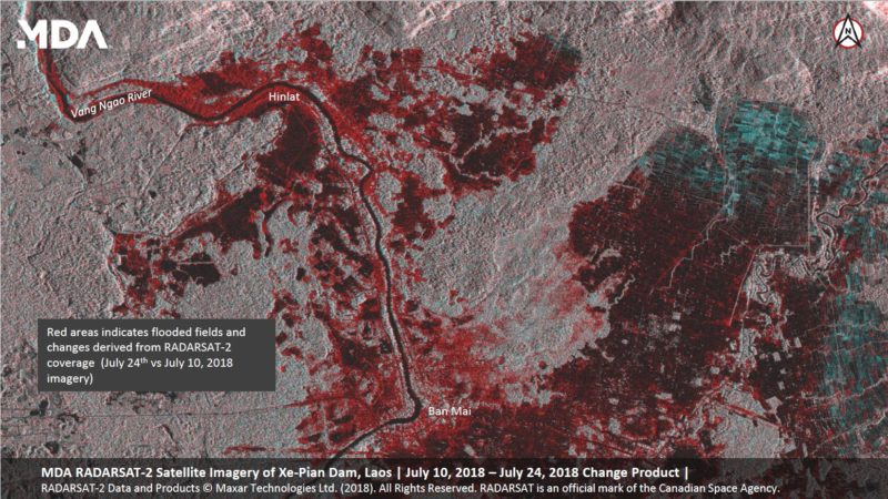
MDA has released radar vector data which can also be downloaded from the Open Data site.
We will continue to update this blog post and our social media feeds as more data becomes available.