The Carr Fire west of Redding, California has continued to spread and cause significant damage. Most of the evacuations have been lifted, however the fires continues to spread in rural areas. The blaze has destroyed over 125,000 acres and is only 35% contained. So far approximately 1,060 homes, and 18 commercial buildings and 477 other structures have been destroyed. It is currently the sixth-most destructive wildfire in California’s history and the 13th deadliest fire on record in the state.
When crises like this occur, DigitalGlobe is committed to supporting the humanitarian community and fulfilling Maxar’s purpose of “Building a better world” by providing critical and actionable information to assist response efforts. As part of our Open Data Program, DigitalGlobe will publicly release pre- and post-event imagery of the affected areas to support disaster response.
Pre-event DigitalGlobe imagery has been uploaded to the Open Data site. Please continue to check the site for updates on post-event imagery.
We will continue to update this blog post and our social media feeds as more data becomes available.
[caption id="" align="aligncenter" width="707"]
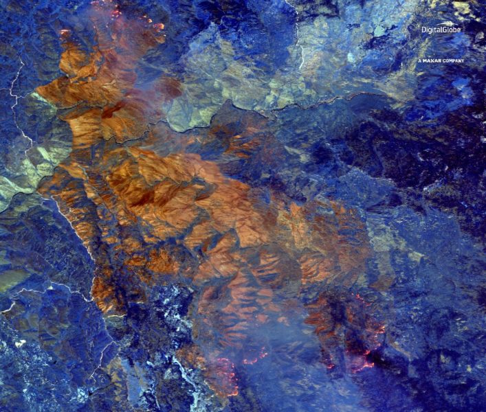
WorldView-3 SWIR image of the Carr Fire near Redding, California from July 29, 2018.[/caption]