 In a previous post, water extractions derived from Landsat 8 imagery were used to monitor Lake Oroville, and based on measurements taken from water level instruments at the reservoir, it was determined that accurate trends could be discovered. Water extractions derived from Sentinel-2 suggest the same kind of monitoring can be accomplished with similar accuracy according to the ground truth measurements provided by California’s Department of Water Resources.
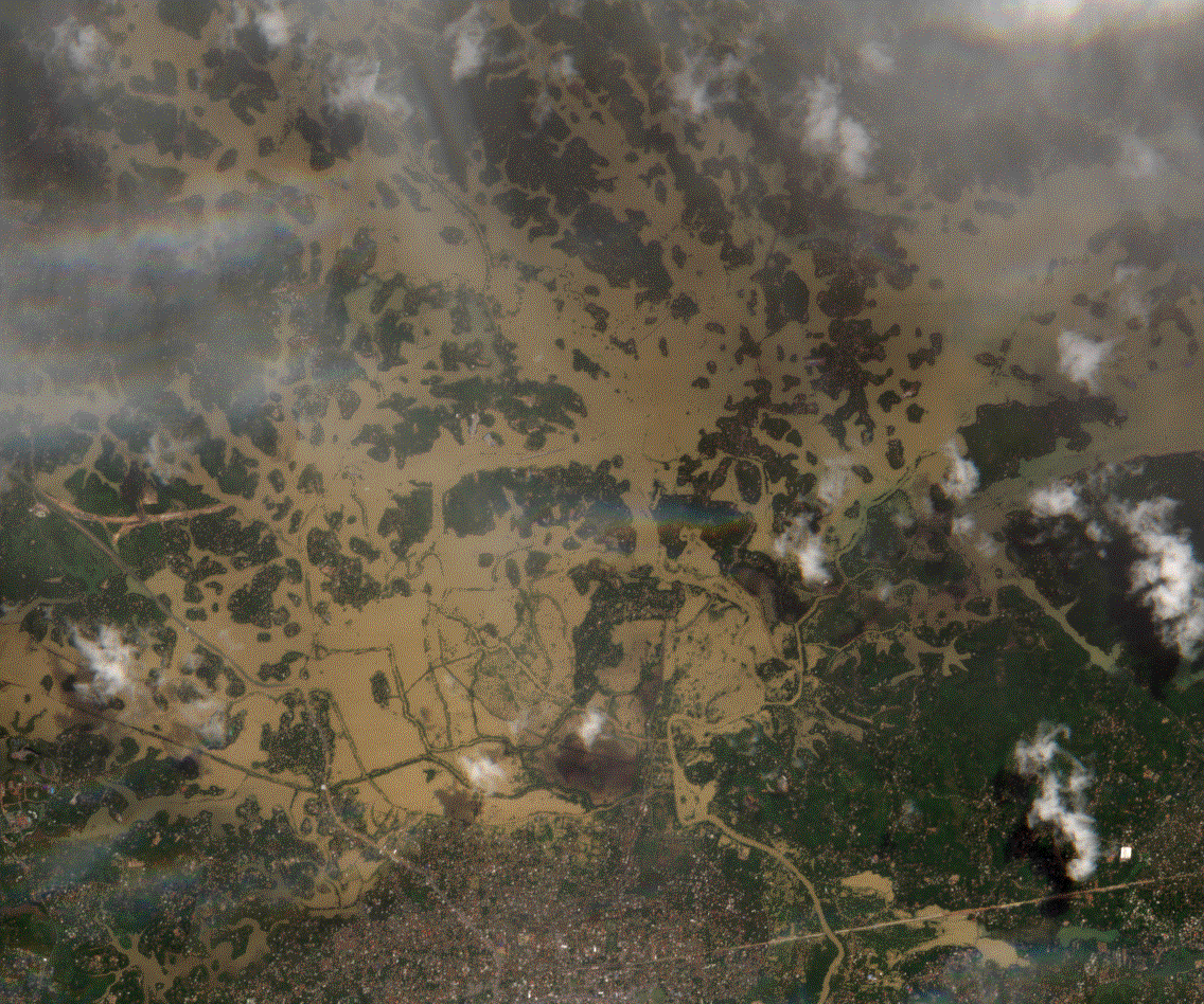
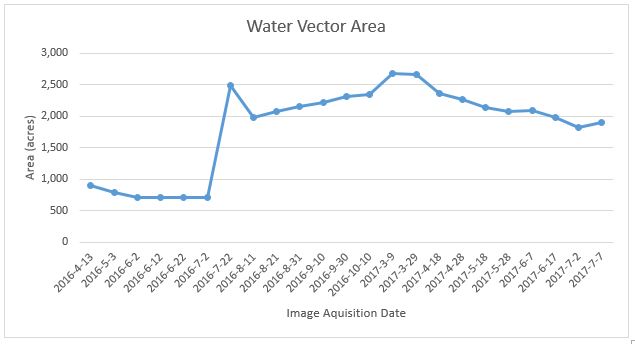
 Since the Lake Oroville case study asserts that this kind of monitoring is viable, the opportunity to take advantage of GBDX’s scalability and image catalog depth is presented. In contrast to Lake Oroville, where daily accurate water metrics are recorded and published for free, there are reservoirs in the world that do not possess the infrastructure to capture that kind of data, or the responsible municipalities do not make it readily available; however, with GBDX that information can still be gathered. For example, Zhuzhuang Reservoir in China and Sidi Salem Dam in Tunisia. The graph spike occurring in July 2016 for the Zhuzhuang image below represents a flooding event.
 [twenty20 img1="5790" img2="5791" offset="0.5"]
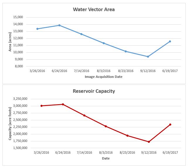
Using GBDX, insights from satellite imagery can be reduced into easily presentable quantitative formats like the graph below, which helps get the main point across for those not familiar or do not have expertise in remote sensing or GIS.
[twenty20 img1="5790" img2="5791" offset="0.5"]
Using GBDX, insights from satellite imagery can be reduced into easily presentable quantitative formats like the graph below, which helps get the main point across for those not familiar or do not have expertise in remote sensing or GIS.
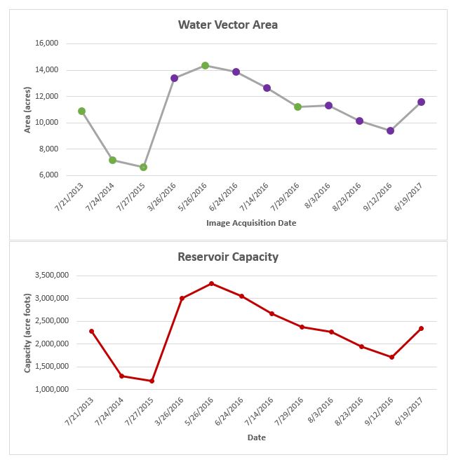
 While Sentinel-2 imagery alone can be used to produce valuable insights, in conjunction with Landsat 8, or even with DigitalGlobe sensors, a more in-depth image stack can be generated for enhanced monitoring to allow for greater situational awareness. In the graph below, the green and purple data points represents Landsat 8 and Sentinel-2 water extractions, respectively.