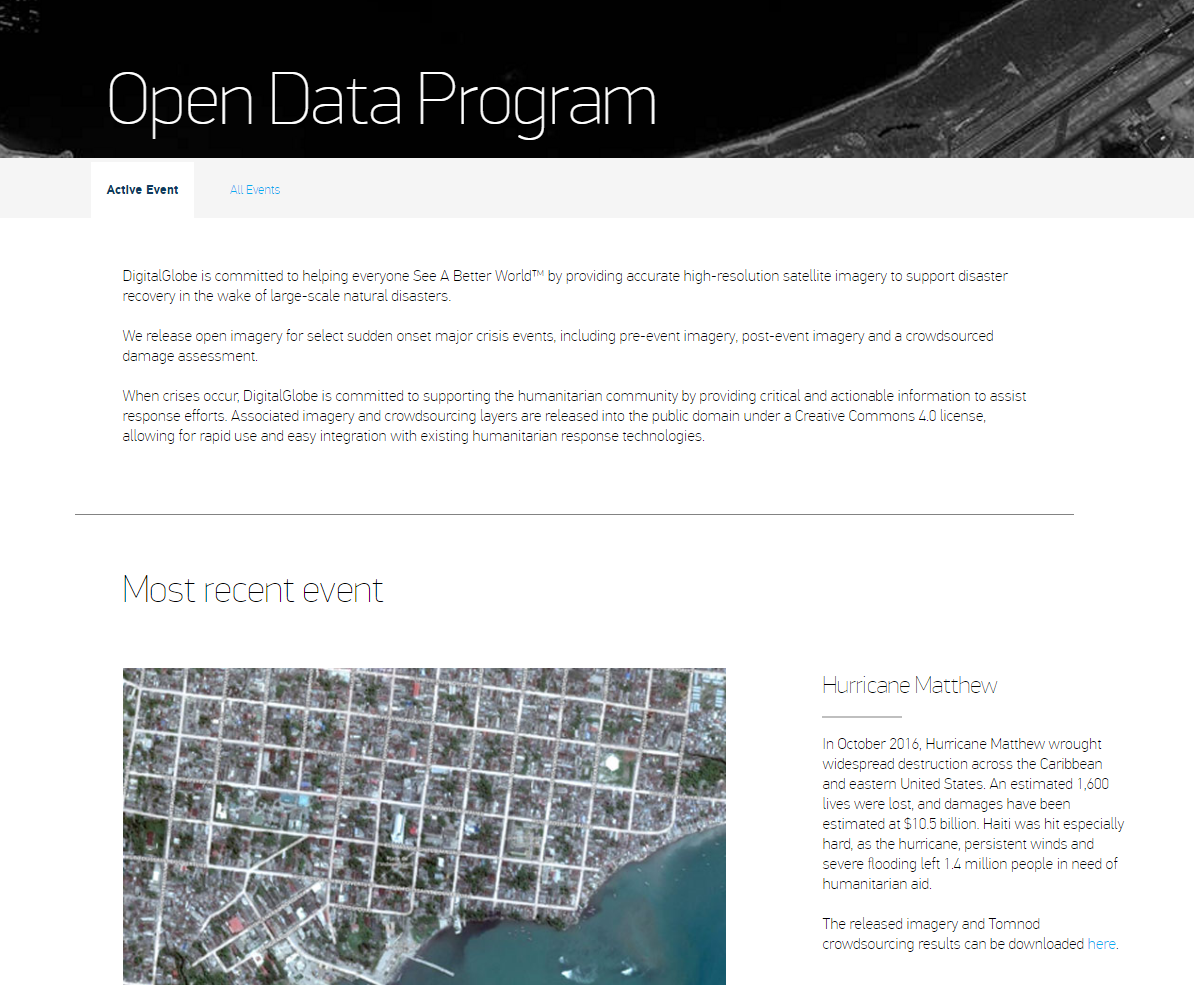
 Since the 2010 Haiti earthquake, DigitalGlobe has supported major disaster relief efforts by releasing free and open imagery of affected areas. Over the years, our very high resolution imagery has provided critical, timely insights in the aftermath of Typhoon Haiyan, the Nepal earthquake, Hurricane Patricia and the Ecuador earthquake, among others. More recently, Haiti again suffered horrendous damage from Hurricane Matthew, leaving 1.4 million people in need of humanitarian aid. DigitalGlobe’s open imagery was mission critical. From damage assessments to flood mapping to evacuation planning, high resolution imagery provides valuable information during these crises.
And while opening up imagery is critical, getting it in the hands of people who know what to do with it is another effort entirely. That’s why DigitalGlobe’s Open Data Program is building a community of practice around the use of imagery for disaster response. Without a partner like the Humanitarian OpenStreetMap Team (HOT), our imagery wouldn’t produce critical insights identifying which communities are hardest hit. Without a partner like Amazon Web Services, our imagery wouldn’t be available hours after disaster hits. Without a partner like the World Bank working alongside government partners in country, our imagery wouldn’t enable coordinated recovery efforts. And without a partner like the United Nations, our imagery wouldn’t reach the dozens of humanitarian and relief agencies desperate for data to guide operational efforts on the ground. DigitalGlobe is humbled to be a partner to these incredible organizations.
You can explore our open imagery here, and we encourage you to join us and our partners in coordinating and improving our disaster response efforts.
Since the 2010 Haiti earthquake, DigitalGlobe has supported major disaster relief efforts by releasing free and open imagery of affected areas. Over the years, our very high resolution imagery has provided critical, timely insights in the aftermath of Typhoon Haiyan, the Nepal earthquake, Hurricane Patricia and the Ecuador earthquake, among others. More recently, Haiti again suffered horrendous damage from Hurricane Matthew, leaving 1.4 million people in need of humanitarian aid. DigitalGlobe’s open imagery was mission critical. From damage assessments to flood mapping to evacuation planning, high resolution imagery provides valuable information during these crises.
And while opening up imagery is critical, getting it in the hands of people who know what to do with it is another effort entirely. That’s why DigitalGlobe’s Open Data Program is building a community of practice around the use of imagery for disaster response. Without a partner like the Humanitarian OpenStreetMap Team (HOT), our imagery wouldn’t produce critical insights identifying which communities are hardest hit. Without a partner like Amazon Web Services, our imagery wouldn’t be available hours after disaster hits. Without a partner like the World Bank working alongside government partners in country, our imagery wouldn’t enable coordinated recovery efforts. And without a partner like the United Nations, our imagery wouldn’t reach the dozens of humanitarian and relief agencies desperate for data to guide operational efforts on the ground. DigitalGlobe is humbled to be a partner to these incredible organizations.
You can explore our open imagery here, and we encourage you to join us and our partners in coordinating and improving our disaster response efforts.