From DigitalGlobe’s unique vantage point from 400 miles above Earth’s surface, our high-resolution satellites can view how rising temperatures affect Earth over time. In a new Voyager story for Google Earth, we take a look at some of these changes. Voyager is a storytelling platform that provides map-based narratives through interactive tours and image galleries. Users experience the stories while having the whole world as context to understand them.
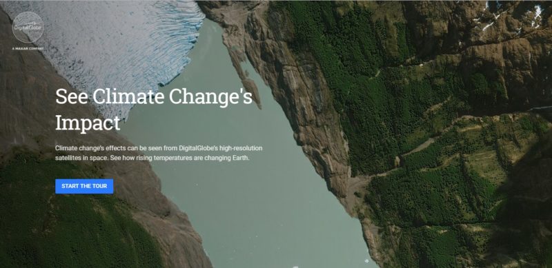
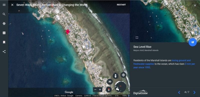
The effects of climate change are manifesting as rising sea levels, dying trees and exploding permafrost. Our Voyager story walks you through the visual evidence and links you to the stories about each example.
DigitalGlobe and Google have partnered for years to bring satellite imagery to the public as a foundational data layer in Google Earth and Google Maps. With Voyager, DigitalGlobe is now able to able to combine its unique perspective with stories on Earth to give viewers a complete understanding about our changing world.
This week, DigitalGlobe is examining how its technology, as well as the technology from MDA and SSL (other Maxar Technologies companies), are monitoring climate change. You can learn more about our work here. New content will be posted each day this week.