Sponsored by Maxar Technologies’ DigitalGlobe and the European Space Agency (ESA) Business Applications, the Earth Observation Challenge launched in April 2018, calling on developers, geoscientists, and innovative minds across Europe to submit tactical solutions using advanced geospatial technology for one of two challenges:
- Identifying water bodies or water changes
- Change characterization in urban areas
Participants received on demand access to the DigitalGlobe 18-year image library and ESA Sentinel-2 data via our cloud-based Geospatial Big Data platform (GBDX), which empowered them to develop and run algorithms at scale.
We excited to announce our three winners:
First Place

Reservoir Monitor - Global, timely, and accurate monitoring of water resources is an essential component to improve management in water-scarce regions. Gennadii Donchyts, a data scientist, created a solution based on a fusion of medium and high-resolution, multi-temporal satellite imagery that estimates high-frequency surface water area changes in any reservoir on Earth. The use of a discriminative-generative method allows accurate detection of surface water extent even in satellite imagery.
Second Place

Urban.Monitor - Rapid growth - without data, facts and efforts to ensure resilience - is exposing cities around the world to huge risks as a result of change that has not been prepared for.. We are committed to accurately mapping urban change using combined high and very-high satellite imagery. A team consisting of Konstantinos Karantzalos, Maria Papadomanolaki, and Maria Vakalopoulou created a deep learning framework that trains, predicts, and detects naturally occurring and man-made objects and their change to better understand the scale, pace and impact to the surrounding environment anywhere in the world.
Third Place
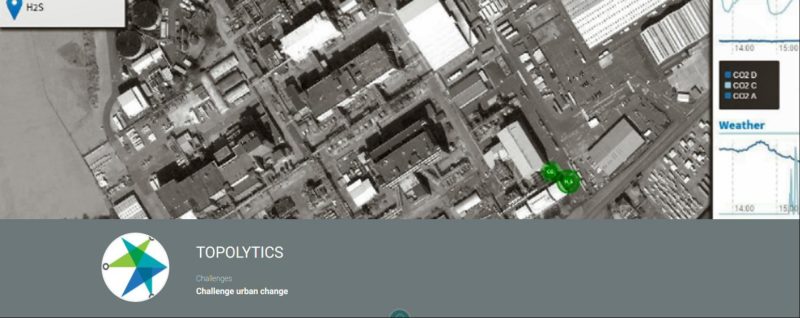
Topolytics – Three people from Topolytics, a data and analytics business, are making industrial and commercial waste materials visible, verifiable, and valuable via two solutions: WasteMap is a geospatially-enabled big data platform for managing, visualizing and analyzing waste material flows, which leverages timely Earth observation (EO) data. WasteTrack combines live data from sensors and other sources to verify the movement of inbound and outbound waste and raw materials. Together, WasteMap and WasteTrack will enable stakeholders in the waste industry to better understand and optimize their processes and generate better commercial, environmental and investment decisions by maximizing the value and utility of secondary raw materials.
This challenge was designed to empower data scientists, businesses, academia and start-ups to build solutions and transform EO imagery into meaningful, geospatial context for business growth and global development purposes with GBDX Notebooks – and each submission delivered a brilliant idea. Congratulations to all the finalists, and thank you to all our participants for your incredible work!
The winners receive a cash prize, 90 days access to GBDX Notebooks, and access to ESA’s incubation network and business development resources.