 [caption id="" align="aligncenter" width="1366"]
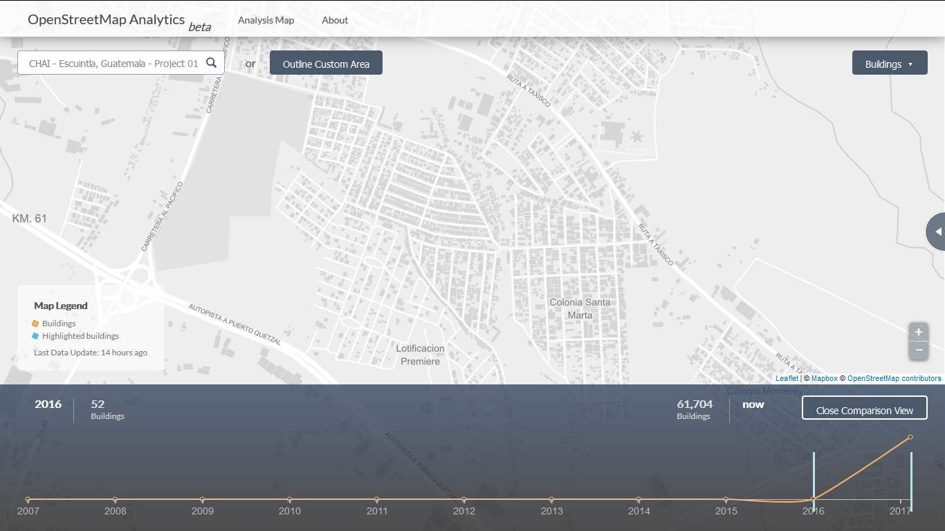
 In Escuintla, Guatemala, volunteers have already helped put 61,000 homes on the map. As part of the ongoing malaria elimination mapping work, DigitalGlobe’s imagery is used to conduct household enumeration across parts of Guatemala, Honduras, Zambia, Zimbabwe, Bostwana, Laos, and Cambodia.[/caption]
“Maps and geospatial data play a critical role in understanding and meeting the needs of populations most affected by malaria,” says Jeff Bernson, director of results management, measurement, and learning at PATH. “Mapping structures with this level of granularity will only further support the Zambian Ministry of Health as they mobilize their resources in their fight to eliminate malaria.”
The cost of malaria to African economies is huge, estimated at US$12 billion a year in direct costs. It consumes 25 percent of household income in high-burden areas due to lost productivity and health care–related expenses. Eliminating malaria would have potentially huge ramifications on these local economies, would free up limited health resources, and would reduce school absenteeism by nearly half.
Help us put these communities on the map. The most important partner in this malaria coalition is you. Without the crowd, we couldn’t enable some of the fantastic work that’s happening right now in Zambia, Guatemala, Laos and elsewhere. Think about that family that lives in the home you’re tracing. The family that needs a bed net to protect themselves from mosquitoes. That family whose children want to go to school and learn every day. That family whose livelihood depends upon being healthy enough to work their fields. These are the families we’re supporting, even from space, even from thousands of miles away.
In Escuintla, Guatemala, volunteers have already helped put 61,000 homes on the map. As part of the ongoing malaria elimination mapping work, DigitalGlobe’s imagery is used to conduct household enumeration across parts of Guatemala, Honduras, Zambia, Zimbabwe, Bostwana, Laos, and Cambodia.[/caption]
“Maps and geospatial data play a critical role in understanding and meeting the needs of populations most affected by malaria,” says Jeff Bernson, director of results management, measurement, and learning at PATH. “Mapping structures with this level of granularity will only further support the Zambian Ministry of Health as they mobilize their resources in their fight to eliminate malaria.”
The cost of malaria to African economies is huge, estimated at US$12 billion a year in direct costs. It consumes 25 percent of household income in high-burden areas due to lost productivity and health care–related expenses. Eliminating malaria would have potentially huge ramifications on these local economies, would free up limited health resources, and would reduce school absenteeism by nearly half.
Help us put these communities on the map. The most important partner in this malaria coalition is you. Without the crowd, we couldn’t enable some of the fantastic work that’s happening right now in Zambia, Guatemala, Laos and elsewhere. Think about that family that lives in the home you’re tracing. The family that needs a bed net to protect themselves from mosquitoes. That family whose children want to go to school and learn every day. That family whose livelihood depends upon being healthy enough to work their fields. These are the families we’re supporting, even from space, even from thousands of miles away.